|
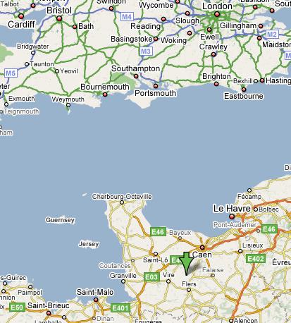
Le Hamel Roger is easily approached from all directions
although when you get close to the house please don't
trust it to a Sat Nav, please use a map! We have included
some directions below to help with the final little
lanes, it is written as if approaching from the A84,
a popular route from most ferry ports and the channel
tunnel.
Turn off the A84 at junction 42 and head south on
the D577 sign posted to Jurques and Vire, after approximately
7 miles (12K) you will come to the village of Montamy,
a mile (1.5k) further on you will come to a small
crossroads.
Turn left at this crossroads towards Arclais. The
road now becomes a narrow and winding single track
road. You will pass through a small group of houses,
which is Arclais. The road then climbs up a hill.
At the top of the hill you will see a large farm on
the left.
Take the left turn immediately before the farm, sign
posted Le Hamel Roger and La Lanterie. (1.2 miles
[2k] from the main road.) Follow the tarmac road to
the end, where you will find us.
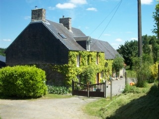
First view...........
|